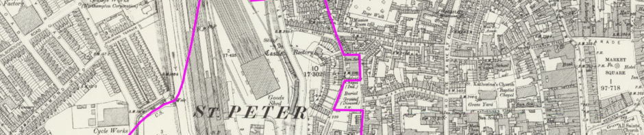
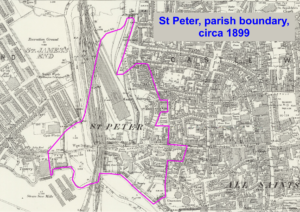
First thoughts are that a parish boundary is something that remains fixed over time. However a little reseach from old maps shows that in fact changes are made, some by design to accommodate a new building and others beacuse of natural processes because it follows the course of a river. The western boundary has moved around as the river has changed course and also when it was re-cut by the LNW Railway for the construction of the castle station. The boundary has also moved around the Castle Hill chapel near the site of the former St Mary’s church. Immediately to the east of St Peter’s there is a particularly interesting rectangular area that is included that was the site of the Saxon halls rediscovered by archaeology in 1973. The map shows the boundary as it existed in 1899.